top of page
Search


Thames Downs Link: Kingston upon Thames to Malden Manor
Kingston upon Thames - Berrylands - Malden Manor Distance: 6.5 km (4.1 miles) Max elevation: 36 m Total Ascent: 46 m Total Descent: 29 m Tracking points: 429 The Thames Down link connects The River Thames at Kingston through to the North Downs at Westhumble and Box Hill. Essentially a flat easygoing riverside and suburban path comprising of both pavement and compressed gravel tracks and covering a distance of 15 miles. This makes the walk achievable in one day but on this occ
Graeme Stoten
May 233 min read


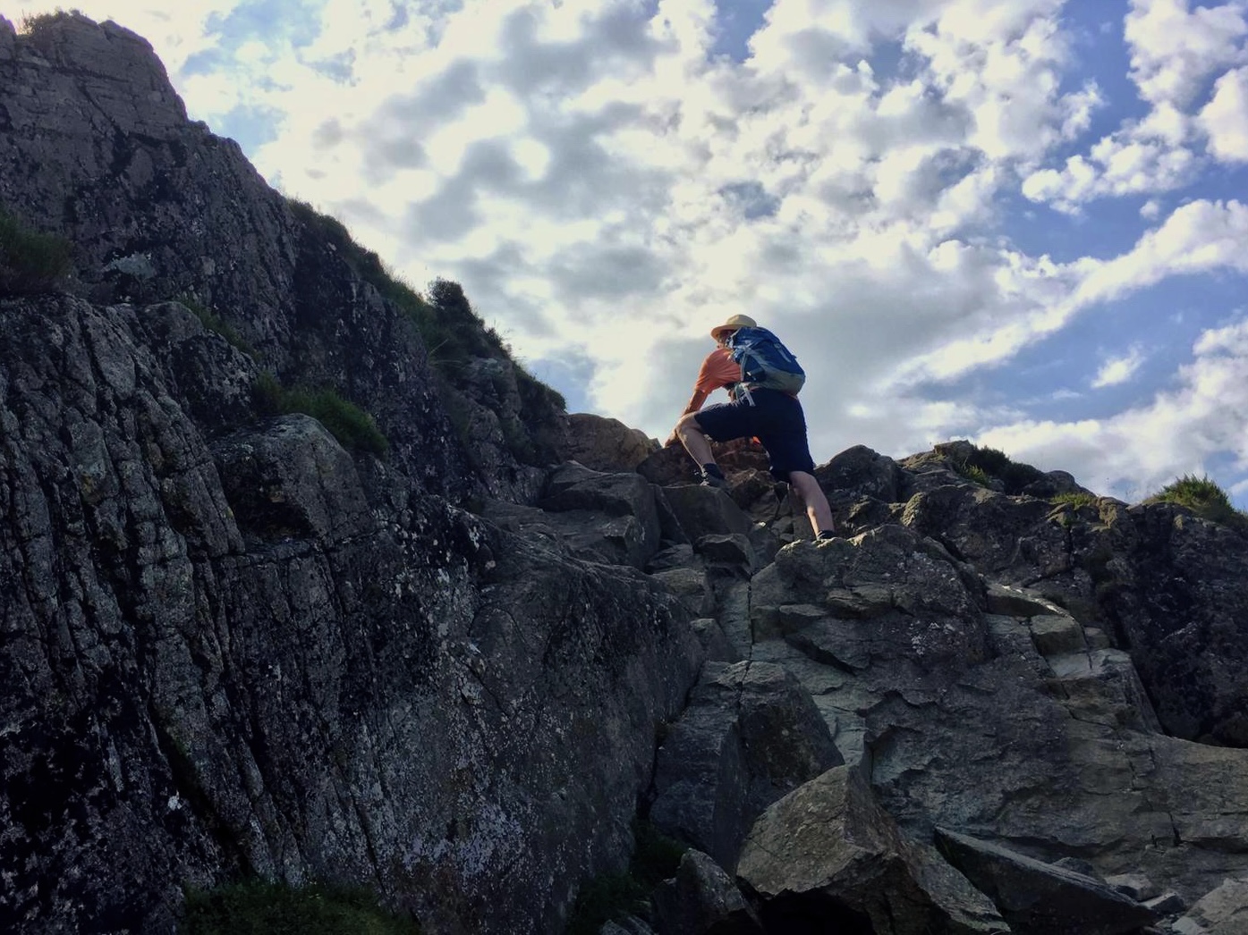
Norton to Caswell via The Wales Coast Path - Gower
Norton - Mumbles - Langland - Langland Bay - Snapple Point - Newton Cliff - Summercliffe - Caswell Bay Distance: 2.8 miles (4.5 km) Max elevation: 61 m Total Ascent: 143 m Total Descent: 156 m Track points: 493 Setting out from the village of Norton and taking Castle road directly south, following on via Limekiln road and passing Mumbles Baptist Church, the route ascends Langland road to reach the village of Langland. Descending Rotherslade road, quickly brings into view the
Graeme Stoten
Apr 171 min read


Oxwich Bay Nature Reserve Circular - Gower
Oxwich (Beach Car Park) - Oxwich Bay - Nicholstan Woods - Nature reserve - Dunes - Oxwich Bay - Oxwich Distance: 4.7 miles (7.5km) Max elevation: 65 m Total Ascent: 221 m Total Descent: 219 m Track points: 720 This popular circular or figure of eight walk explores the Oxwich Bay nature reserve utilising the Wales Coast Path. Upon our arrival the tide was very low so set out to walk along the firm beach before arriving at Nicholstan Woods. Passing the Burrows and the Dunes,
Graeme Stoten
Apr 171 min read


The Dyke Railway Trail - The South Downs
Hangleton - Dyke Hill - Fulking Hill - Mount Zion - Foredown Tower - Hangleton Distance: 7.1 miles (11.3 km) Max elevation: 217 m Total Ascent: 303 m Total Descent: 270 m Track points: 825 This lovely ramble utilises part of the disused Dyke railway line which ran from Hove up until 1938, and is now a walkway that gently climbs up onto the South Downs, The walk begins from Hangleton Valley Drive close to the Manor, up past the Norman built St. Helen’s church, then further o
Graeme Stoten
Mar 72 min read


TMB: Synopsis ‘ a look back…’
View SE from Refuge de La Croix Bonhomme Trail overview The Tour du Mount Blanc or TMB as its better known amongst hikers, is a...
Graeme Stoten
Sep 8, 20257 min read


TMB: Stage 11 - La Flegere > Chamonix via Planpraz
Duration: 3 hrs Distance: 4.7 km Ascent: 282 m Descent : 98 m Trail: Main route/Plan Praz - Cablecar Refuge de La Flegere > Charlanon...
Graeme Stoten
Aug 14, 20251 min read


TMB: Stage 10 - Argentiere > La Flegere via Lac Blanc
Duration: approx 4 hrs Distance: 8.9 km Ascent: 1128 m Descent : 513 m Trail: Main route/ link via Bois du Plagnolet Argentiere > Le...
Graeme Stoten
Aug 14, 20251 min read


TMB: Stage 9 - Trient > Argentiere
Duration: approx 5.5 hrs Distance: 15.2 km Ascent: 1065 m Descent : 1098 m Trail: Main route/Low level variant to Argentiere from Tre -...
Graeme Stoten
Aug 14, 20251 min read


TMB: Stage 8 - Champex > Trient
Duration: 5 hrs Distance: 15.4 km Ascent: 797 m Descent : 991 m Trail: Main route Champex - Lac > Champex d’en Haut (1440 m) Champex d...
Graeme Stoten
Aug 14, 20251 min read


TMB: Stage 7 - La Fouly > Champex
Duration: approx 4.5 hrs Distance: 15.3 km Ascent: 561 m Descent : 681 m Trail: Main route La Fouly > Amone (1550 m) Amone > Forest path...
Graeme Stoten
Aug 14, 20251 min read


TMB: Stage 6 - Val Ferret > La Fouly
Duration: approx 7 hrs Distance: 21 km Ascent: 1236 m Descent : 1273 m Trail: Main route Lavachey > Rifugio Bonatti ( 2025 m) Rifugio...
Graeme Stoten
Aug 14, 20251 min read


TMB: Stage 5 - Courmayeur > Val Ferret
Duration: approx 5 hrs Distance: 14.2 km Ascent: 987 m Descent : 565 m Trail: Main route Courmayeur > Villair Desot Villair Desot >...
Graeme Stoten
Aug 14, 20251 min read


TMB: Rest Day - Courmayeur
Staying at the very comfortable Hotel Cresta et Duc, Courmayeur provided an excellent location to take a days rest. With hotel sauna,...
Graeme Stoten
Aug 14, 20251 min read


TMB: Stage 4 - Val Veny > Courmayeur
Duration: approx. 4 hrs Distance: 7 km Ascent: 508 m Descent : 1255 m Trail: Main route / Plan Checrouit cable car Cabane du Combal >...
Graeme Stoten
Aug 14, 20251 min read


TMB: Stage 3 - Refuge Bonhomme > Val Veny
Duration: approx. 7 hrs Distance: 23 km Ascent: 1031 m Descent : 1504 m Trail: Main route Refuge du la Croix Bonhomme > Chalets de la...
Graeme Stoten
Aug 14, 20251 min read


TMB: Stage 2 - Les Contamines > Refuge Bonhomme
Duration: approx. 6 hrs Distance: 13.9 km Ascent: 1341 m Descent : 79 m Trail: Main route Les Contamines > Gite le Pontsticill (1170 m)...
Graeme Stoten
Aug 14, 20251 min read


TMB: Stage 1 - Les Houches > Les Contamines
Duration: approx. 6 hrs Distance: 12 km Ascent: 650 m Descent : 1040 m Trail : Main route / Variant 1 Depending on choice of guidebook or...
Graeme Stoten
Aug 14, 20251 min read


Porth Dinllaen circular - Snowdonia
Distance: 4.6 miles ( 7.4 km) Total Ascent: 135 m Total Descent: 145 m Max. Elevation: 42 m Track Points: 987 Mona Nefyn - Port Dinllaen Farm - Amber Geirch - Nefyn and District Golf Club - Borth Wen - Trwyn Porth Dinllaen - Ty Coch Inn Porth Dinllaen - Wales Coast Path - Penrhyn Nefyn
Graeme Stoten
May 31, 20251 min read


Nantmor - Llyn Dinas - Beddgelert circular - Snowdonia
Distance: 5.6 miles (8.9km) Total Ascent: 459 m Total Descent: 465 m Max. Elevation: 296 m Track Points: 1285 Nantmor - Cwm Bychan - Bwlch-y-Sygyn - Grib Ddu - Afon Goch Llyn Dinas - Affon Glaslyn - Sygun Copper Mine - Ty hen - Beddgelert - Welsh Highland Railway - Aberglaslyn
Graeme Stoten
May 31, 20251 min read


Rail and Heritage Loop: Waterloo to Paddington
Waterloo Station - Victoria Station - Paddington Station: 5.3 miles (8.5 km) (Courtesy of Footways/GPX Viewer) Waterloo Station -...
Graeme Stoten
May 21, 20252 min read
bottom of page